luna
-
Content Count
73 -
Joined
-
Last visited


-
I slime, have UHD Bridgestone tubes. I ride desert & Baja, I don't want to be on side of the trail for 45 minutes changing a tube, having people wait on me.
-
I did a full factory reset, reprogrammed, but didn't use the "Fixing poor squelch" settings and was able to hear. Thanks Amgems for the help.
-
Need help on either programming side CHIRP or disc image side or radio setup. I'm a total novice to radios. So this past weekend I programmed radios on CHIRP. I programmed a UV5R (NA/771) and a BF-F8HP (stock antenna) . I was tired of carrying around a piece of paper to find out what channel the Rugged Radio guys were on, Checkers, FAIR,BFGRELAY, etc. So I inputted into CHIRP the the numbers for the names, so for ease could go straight there. Put the squelch number, from fixing poor squelch. My issue was when I was at Superstition on Wheeler Rd., everyone with their stock UV5R could hear the UTV group at top of Super, but me with my UV5R. I was so bummed. I just did a complete reset on the trail, figuring it had to be the squelch settings, or maybe the TONE or TONE SQL. I honestly don't know why wasn't able to hear, as radio's aren't my thing. Programmed for simplicity, but off somewhere obviosly. https://www.ruggedradios.com/PDF/RuggedRadios-FCC-Approved-Channels.pdf https://cdn.shopify.com/.../Baofeng_Stock_Freq_Web.pdf... https://www.mag7race.com/pdf/channel.pdf Fixing poor squelch
-
Wanted to add I had someone message me, asked if I had a screen saver on mine. I forgot to add it to my page 1, but yes I do. Click below. Kyocera DuraForce Pro Screen Protector
-
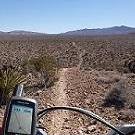
IMO regarding maps, and people who stop on the trails, it's because either didn't zoom in close enough when making a track (.gpx/.kml file), so it's hard to see a trail head when looking for single tracks because it looks like a straight line of connect the dots.. You can make a quick track in 5 minutes, but when going on single track rides, you need to be zoomed in when creating tracks.This will take about a little more time, as it'll be more detailed. Always ask to get a file emailed, and download it. That is why before a ride and going on a ride, I always ask for .gpx/.kml file so I can download it on Google Earth first and see if it needs altering, to not miss trail heads. Plus if you have .gpx/.kml file you can always download to your phone if you have an app, and find your way out too. Now regarding Garmin unit to a Smartphone,to me it's a no brainer. Smartphone. Make tracks, share tracks, use the web, use Google Earth, use email, as long as you have hotspot or Wfi. 1/4 of the cost. The biggest negative to a smartphone, is it is not user friendly at first when using apps. If you are not tech savy, it will take two weeks. I also recommend getting an app, your group uses. I always recommend when learning a smartphone with an app, just leave it in your car, and use it driving around town. Can mess around with it daily till you get the hang of it. Positive is the size, can't compare. Here is my Garmin Montana 650 vs Kyocera DuraForce Pro. Way better to read and see. These both have California Trail Map installed. Also let me say, I do not ride on the road, I ride primarily offroad and single tracks. Will take a road if I have to interlink, but try to stay off asphalt for my tires sake. lol
-
All excellent descriptions above. Highly recommend, after next ride and it doesn't leak, pull one that leaked and replace fork oil, it's contaminated. Add either MFG suggested oil height, call your suspension shop see what they put in, or pull other fork that didn't leak measure fork oil height and match both fork legs to non leaked fork. If you do the latter, might as well put fresh oil in both forks, fork oil is cheap.
-
RobT2K it doesn't appear that https://www.californiatrailmap.com/ has a trial version. To get an idea what it would look like on your phone, here is a video CTM made. Disregard the talk of Basecamp, that's for your PC, I want you to see visual of what it will look like the trails on your phone. Start at the 3:30 mark if it didn't set to play from there. Here is the purchase, you can pick one year or lifetime, it's a no brainer going lifetime, with how much one year cost. https://www.californiatrailmap.com/Purchase.aspx
-
*****Disclaimer: When riding in the USA, 99.9% of the time I have California Trail Map on my phone as map to use when riding. To me it's amazing.*********** Satellite images for me are bail outs. It's my safety plan. I never use them for maps while riding. Too hard to see. I always ride in Topo mode, if not using California Trail Map. I don;t try to find new single tracks while on a ride. I'll look for new single tracks, at home on my PC, and make a route. Nothing worse then looking at your phone, and killing the flow, trying to connect new trails, while on the trails. That's actually a really good video, posted above. That's a great crash course of loading maps. That's same website also I download my Vector Maps. On that video at 1:35 you see the G for Google, they click on the G and it does a drop down with map choices. There in that drop down, you can see maps you can use/download since you downloaded the Locus Map Tweak. When you do your first download, I recommend just do your neighborhood a few blocks. Click on the three dots next to hybrid. Click download Click Select Area, you can adjust the perimeters (this is to see how big or small an area. First one small, your neighborhood) After you select your area, click the Blue check. You'll come to a screen and it has zoom levels. ( Since you're doing your neighborhood area, click them all. The more zoom, the more tiles you use. Limited to 10K a day for Google only) Above zoom, you can name your file. Click Download. That's it your done. When doing a large area, I leave my phone by coffee pot due to Google 10K restriction. I just wake up, go to coffee,grab my phone that's connected to WiFi, go to offline tab and press the file you named and click "Continue Download". I do this everyday till whole Google Satellite Map is downloaded. More zoom and bigger the area, more tiles you'll use.
-
Amgems, I assumed you had Locus App. Why on page 1 at the bottom, I posted the photos of my offline maps. I wanted you to see the "G" that you can have Google on Locus. You asked for Satellite images, I showed you it can be done in Locus, if you install the "Locus Map Tweak" add on. If you had Locus, you would know, there is no Google maps on Locus. In order to get Google map on Locus, you have to install "Locus Map Tweak" add on. Only Google map downloads are restricted to 10K tiles per day, on Locus. Again only applies to Google Earth, not any other map. All other maps that are available to Locus, is an instant download. So whatever map you download will be instant and whole map will be there. I recommend should you want to use Locus, to read the entire/most thread on ADV Rider. I think you reading/talking about GAIA and LOCUS at same time is confusing you. One does not apply to the other. Like PC vs Mac. Way too hard to learn both same time. I used to only use GAIA too. I stopped using GAIA when they started to charge a subscription fee. GAIA is an excellent APP. I highly recommend you stay with GAIA, sounds like you're starting to get comfortable with it. I would pay the $40 subscription fee, just so you continue to learn you're way around that APP.
-
Oracle, we had a rider experience what I think you had with the magnetic plug. The round silver magnet that is in the black housing, came loose, had a ton of play to the magnet on the phone. We thought the insert in the phone was moving, but it wasn't. It was like it had a little play. So if you pulled on it slightly the silver round magnet in the black housing would extended a few mm. Once it did that, it didn't stay on or wouldn't charge. We pulled out the magnet by standing it up on metal countertop, once it was out we reapplied adhesive to it (We used Shoe Goo, I'm sure super glue would be fine) and pushed the magnet all the way back into the housing, and it's back working perfectly like the rest of ours, on the last ride. I've ripped/destroyed two mini usb ports out of the phone on Eastern Sierra rides due to single track riding branches, why I went magnetic, and have had zero problems myself.
-
I don't know where you're reading this stuff, but all that sounds to me like, User Error.
-
amgems, I'm on Andriod OS. I use Locus Map Pro(one time $10.99), which is Android OS only. They do have a "free" version to try out. My phone is strictly "offline". Locus Map Pro, not sure on Free, does do offline satellite maps, you would have to download what is called Locus Map Tweak This gives you the ability to download Google Maps. However you're limited to 10K tiles of download a day. The more you zoom in, the more tiles you'll need to download. I downloaded, Baja from Sawmill to Border, due to so many new gates, or exploring new single tracks, wanted to be able to zoom in, and connect to another trail, or if a rider got mechanical/hurt, have bail outs. I also added an external memory card to my phone too. The guys on advrider forum are masters of GPS Apps. How I learned to do mine. Here's the link for Locus thread Tons of Locus info here This how much I can zoom in on my offline Satellite
-
What I'm about to post, I was asked to share on motorcycle group. The number which I got these texts from, also said to give the group his cell if you'd like to help in the search 619-322-8065 I don't know this man, but I would want people searching for me. I post to try to keep updates as I learn and we are able to search areas they are looking, especially those that know the areas. Yes some of it maybe second or third hand, bottom line we are searching to find someone who's missing. This is a motorcycle forum, so helping my fellow motorcyclist on where they could help to look. ****disclaimer my memory sucks, but I believe this is Joel's brother's cell that texted me, I forgot his name***** Here is what I got to texted me last night at 11:03pm, This what they had on new Pings yesterday. This is the text I received this morning at 9:00am. He said this is an update Ping Map with all Pings.
-
The post regarding where he lived was from me, I was being told this by someone at the Pio Pico while they were there. Yeah it was second, third hand. . Maybe they misunderstood that he enters by the San Ysidro/prison. That's more to get out where he would enter/return from. Anyways lets hope he's found. I was out there today looking, didn't find him. Hopefully family will post about today, where they searched, and any new info/updates they received. Awesome to see all the guys/gals searching.
-
Just got a call from his good friend. They are thinking he is off Otay Truck Trail between Doghouse junction and the bottom towards the prison. Sounds like there will be a lot of hikers/walkers/searchers on that Otay Mtn Truck Trail today scouring to see if he is in the bushes, camouflaged. The road from Doghouse Junction to the prison. Been told he lives in Eastlake so thinking, the route back home. If you'd like to help in there search today, he said people can call/text him. He'll let you know areas that have been covered, so don't have to search there. He would like to know, if anyone knows the gunmen/person who supposedly talked to Bob at 1pm on Saturday, by the Sycamore Entrance. Please call if you'd like to help he'll tell you where they are currently looking and already looked, and any info on the person/gunman that saw him at 1pm on Saturday. Do not call for updates, only if you can go to help only, or info on the person/gunman.