

EddieEarl
-
Content Count
461 -
Joined
-
Last visited
Everything posted by EddieEarl
-

Breakfast Club rides again
EddieEarl replied to Covered in Dust's topic in Informal Local Rides & Who's Going Riding!
Last Monday I rode with Bags and it was a perfect pace ... plus he knows the trails (I don't). I'll hang with you guys. -
Breakfast Club rides again
EddieEarl replied to Covered in Dust's topic in Informal Local Rides & Who's Going Riding!
Maybe not a bad idea ... split up by bike size? Pace preference? I'm riding a 500 EXC and prefer a fast pace. -
Long days = Two'fer Tuesdays (two wheels, two trails, two brews, one sunset)
EddieEarl replied to Crawdaddy's topic in Informal Local Rides & Who's Going Riding!
Ramona was HAMMERED tonight with a massive thundershower. It was quite a spectacle. I can't make this ride tomorrow but somebody might want to call the Ranger station to see if the gates are closed (most likely closed). -
Lyndon Poskitt - Races to Places: The Baja Rally
EddieEarl replied to Goofy Footer's topic in Baja Info, Upcoming Rides, Ride Reports, Photos, etc.
good stuff! -
Breakfast Club rides again
EddieEarl replied to Covered in Dust's topic in Informal Local Rides & Who's Going Riding!
Hah. Nice. Yeah to me VET is code for "EXPERIENCED HAUL ASS DESERT RIDER". I rode with Bags last Monday. He's definitely a VET rider. -
Breakfast Club rides again
EddieEarl replied to Covered in Dust's topic in Informal Local Rides & Who's Going Riding!
Gotta say I'm pretty fired up for this Breakfast Club and ripping around with you vets thru the dez! I've been riding dez for a while, but I'm a complete noob to the ADBSP. What are some of the more iconic and popular rides / waypoints out there? And what kind of mileage are we talking about between fuel stops? -
Bags - just heard back from VR support. The guy, Mike, is fantastic. Here's what he had to say: ViewRanger Request Update View the complete request history Hi Troy, Sorry, we don't have set sof points like this, though are intending to add them before long. The free Landscape or Open Cycle Maps (Options, lower left on map, Choose a map, Online maps), have quite a lot of POis marked. Regards, Mike.
-
Yes - but in a round about reverse engineered kind of way. Short Version: I actually go out and ride first, then come back to the map to figure out where and what I just rode, see how that train is "CODED" in "California Trail Maps" (CTM) and then try and find more trails that are CODED the same way within CTM. It's still not easy. I bought the CTM data a while back. It's incredible ... almost too incredible. There is SO MUCH data available it makes it a bit hard for me to use for a few reasons (maybe more on that in a different thread). The biggest bummer with the data for me personally is that the CTM data is in a unique format -- I think it's an "MBX" format -- which does not import into VR so I have to use a different mapping app for it called "Locus" and I just don't like Locus near as much as VR. So, what I'm starting to do is record my TRACK in VR and then import it over into Locus where I have all the CTM data. And here's why ... I dot that b/c if I know I just rode a killer two track (like I did on Monday with Bags) then when I look at what that trail was "CODED" by CTM then I can begin to find other trails CODED the same way. For example, on Monday Bags and I rode Grapevine, then up and over the ridge via Jasper TT ... KILLER two track stuff. We circled down into Borrego, rode some sweet sand for a bit then headed south to the 78 along a BITCHIN 2 track pole line road (pretty sure it was Cactus Valley TT). Since I recorded the TRACK in VR I was then able to really easily import over into Locus, and since all the CTM data is in Locus I could see that EVERY SINGLE ONE OF THOSE BITCHING 2 TRACK, FLOWY, FAST TRAILS was coded the exact same. It was coded as follows: "Dirt Road - Major" (smooth grey line below). Here's how it showed in Locus app (Cactus Valley TT was a solid grey line): So, I guess I need to find more "Dirt Road - Major" trails in CTM!
-
Yep - no problems swiping at all. Sometimes my riding gloves make it a bit interesting, but the high impact glass screen protector and/or the otterbox case doesn't effect it at all. As for waterproof or resistant I think all these say "resistant". My wolfmans are technically not even water "proof". But, for all practical purposes this holds up in the rain just fine. In fact, one time I dropped my phone in a river and quickly pulled it out, took it out of the case, and dried it off ... ended up just fine. Now, if I had left it in the river for a day and came back and got it I'm sure it would have fried. But, it did good enough to protect the phone for the few seconds it was totally submerged. What's interesting (and I'm really, really close to pulling the trigger on this one) is Samsung just came out with a fully water PROOF phone. You can drop that thing in the water WITHOUT a case and it still works. In fact, at a cell phone store I saw the display for this phone and it's a fully enclosed plastic tank with the phone inside ... you press a little button on the bottom of this plastic tank and it fills up with water ... fully submerging the phone ... no issues. Pretty impressive. Anywhoo ... my Galaxy is just fine in the otterbox when it comes to rain. I've had no issue (don't ride much in the rain either, though ... thanks to So Cal weather).
-
Not sure if VR would have that, but I do know that Google's maps are available in VR and I imagine these maps would have that info pre-programmed. Also, if you're using your phone I know Google would have it (and of course if you were within cell range), meaning you could just pull that up on a Google search and route that way. As far as a pre-programmed data feed inside VR which contains certain POIs like gas/groceries ... not sure. I'll email the developer.
-
Wonder how long a cell phone would work attached to a Ram Mount. I doubt they are Ruggedized. * Believe it or not I've been using my everyday cell phone on this Ram Mount for a couple years now. I spent about $75 for a great case (Otterbox Defender) and pop out the flimsy plastic screen protector which comes with the case, and then I replace it with a rugged glass high impact screen protector (about $45). The great thing about Otterbox is there is a LIFETIME warranty. When it wears out you get a new one ... FREE. No gimmick. I've actually done this two times already - it's legit. They send you a new one. I am a HUGE fan of Otterbox cases. ViewRanger Rout: Handset = ??, Topo24k = $15.60 Routable ?? * Sorry - I'm still a bit new to the GPS world so I'm not sure what "routable" means? If it means having the abilitly to pre-plan routes then yes ... VR is incredible for this. In fact, using their online (PC / Computer) interface you can place a few POIs (Points of Interest) along what you perceive to be a great trail and then tell VR to plan the route ... it'll connect the dots in order and give you route (which of course then syncs to your phone so you have out on the trail). * If you use your "eveyrday" cell phone the cost would just be for the case & screen protector ($120'ish) and then $20 for VR (it's a $15 base fee, but then a $5 upgrade for every single map they have ... ONE TIME cost, no monthly, no annual). Another thing I forgot to mention is that by riding with my cell on the bars I also have COMS, Music, and EMERGENCY COMS. COMS - I use a Sena ($150) with a BlueTooth connection to the phone (NO WIRES!!!) and which has incredible clarity to other Sena riders. Of course you can talk on your phone while riding, too. Pretty cool. And it's not a "PUSH TO TALK" type function where you have to push the toggle every time you want to talk. You push it once and it opens up a COMS channel and stays open. If you're listening to music and somebody chimes in then the music automatically pauses. When you're done chit-chatting the music resumes by itself. Very cool. You can even "share" your music for other Sena riders. MUSIC - if you've never ridden to music, ... then, well ... I really think you're missing out. I absolutely love it. With the Sena's BT connection to my phone I simply listen to the playlist on my phone. There is nothing like riding to a little G&R while blasting down a pole line road, or Skynyrd's Free Bird on a flowy 2 track. Good times. EMER COMS - for big multi-day trips I bring my In Reach, which of course pairs to the phone, which of course then rides on my bars ... which means I have SAT COM TEXTING ability from my phone. I've learned the In Reach is really like a SAT STREAMING device and works better when used from the app on my phone than compared to using the device itself. Anyway, sorry to ramble, but this has been a bit of a labor of love for me. I used to ride with a short wave ($350) and a Rugged Radios PTT system (f***ing spendy at $450) and I've put it all away. I hated the wires, it wasn't conducive to any kind of music solution, GPS solution, or EMER COMS solution. Now, with the wireless Sena, phone on my bars, and In Reach in the pack I've got an all in one ... WIRELESS ... solution for mapping, GPS, Music, COMS, and EMER COMS. It works for me at least. Oh yeah, I also ride with an Anker Powercore 13000 (palm sized portable battery charger) which gives me 3-4 full phone charges and it has the "quick charge" function so it can charge my phone in an hour (I also use it to charge the Sena, Go Pro, In Reach). This little Anker is AWESOME. I used it like crazy on our last Moab trip. I also have a hard wired cig lighter type power port on the bike which I routed to one of the Wolfmans so I'm always charging the Anker while I ride. Anker (apx $35): https://www.anker.com/products/A1215011 Power Port (apx $40): I got mine from RJ @ All American but I think there are better solutions. Good thread here: http://www.thumpertalk.com/topic/899643-external-power-socket/ Endless options really. Riding dirtbikes is pretty friggin cool. So different than when I started and I can only imagine where its going next. Something like voice controlled goggles or visors with full on heads up digital displays which will lets you do things like beam in your buddies mug so you can video chat while riding, or sync to your bike's computer so everything from power mapping, ABS, and suspension can be controlled by voice. Full on ironman type stuff. It's coming. And when it does I'm buying it.
-
Not sure but I think as long as the app is open it does this automatically. You could also insert POIs (Points of Interest) as you rode which would be like manually laying down a bread crumb, or you could also just record the ride and then back track to where you started. Another function I forgot to mention is called "Buddy Beacon" which is the ability for all VR app users to see where each other is on the map. Pretty cool.
-
Breakfast Club rides again
EddieEarl replied to Covered in Dust's topic in Informal Local Rides & Who's Going Riding!
Does anybody ride with a Sena? -
Dave - great question. Have you come across more mapping options to show the two track roads in Anza Borrego for example. * Not really - I use Google's satellite maps to explore around. Still getting my mind around the phone having actual satellite communication. There must be detail maps for download before remote travel. * Yeah, it's pretty crazy our phones are communicating with GPS satellites. The "TRACK" I can record via the VR app is extremely accurate (precise location / date / time while riding.) * And, yes - the detail maps are stored BEFORE travel. It's called being able to "cache" a map. So, on my phone I can go in my VR app and "cache" (or save) the entire ABDSP area to my phone with the map type that is a hybrid of TERRAIN and SATELLITE IMAGERY. Then, when I ride, I place my phone in "Airplane Mode" (to save battery) and just keep the VR app open so I can see WHERE I'm at on a TERRAIN / SAT IMAGE map. It's pretty cool. I wonder if there are sacrificial phones available ( without cell contract ) and would that work with the system? * I'm not sure if a cell phone without a cell contract can pick up a GPS signal. Great question.
-
i forgot to mention that link should be interactive ... the photos/stats on the right of the page, as well as the graph on the bottom (speed, distance, altitude) ... this app is really friggin cool ... incredible functionality for a $20 one time fee
-
Breakfast Club rides again
EddieEarl replied to Covered in Dust's topic in Informal Local Rides & Who's Going Riding!
I'm in. STOKED. Thanks for setting up! I also just started a thread on GPS forum ... I've been working on a solution for a while and found something that works pretty good for me at least. -
50 Miles of Imaginary Winter
EddieEarl replied to Bagstr's topic in 1 to 3 Day Ride Write-Ups, Stories and Photos
Shoot - TUES is the worst day for me, but I could make it work later in the morning. I assume as fall/winter sets in that leaving a little later isn't such a bad idea, right? (warmer temps) Does MON or WED work just as good? -
50 Miles of Imaginary Winter
EddieEarl replied to Bagstr's topic in 1 to 3 Day Ride Write-Ups, Stories and Photos
I think logging all 500 miles of the ABDSP is a worthy goal this riding season. Im up for a weekly ride to do just that. Next week ...what day we riding? Where we meeting? -
50 Miles of Imaginary Winter
EddieEarl replied to Bagstr's topic in 1 to 3 Day Ride Write-Ups, Stories and Photos
Great ride today, Bags! Thanks for leading and giving me the run-down. 30 years ago I learned to ride a dirt bike in Ocotillo and since then I've really only kept to the old-shool area. I've known about ABDSP and have been wanting to get out there for a long, long time. The trails today were awesome - had a blast - and I'm looking forward to exploring some more! GPX track: Grapevine - Jasper TT - Borrego.gpx -
Breezy in Anza Borrego Monday & Tuesday
EddieEarl replied to Bagstr's topic in Informal Local Rides & Who's Going Riding!
Nice. Looks great. I'm riding a 500 EXC. Looks like perfect terrain for that. I can't meet in Julian but can meet up at the Campground. What time are kickstands up? Thx for posting the ride. -
Breezy in Anza Borrego Monday & Tuesday
EddieEarl replied to Bagstr's topic in Informal Local Rides & Who's Going Riding!
Is this mainly two or single track? Technical or flowy? -
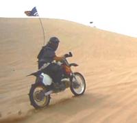
Somewhere roosting over the rainbow
EddieEarl replied to TexasDualler's topic in 1 to 3 Day Ride Write-Ups, Stories and Photos
That is an absolutely bitchin picture. Wow. -
Help! In Laws are coming! Let's go to Baja!
EddieEarl replied to EddieEarl's topic in Baja Info, Upcoming Rides, Ride Reports, Photos, etc.
I'm open for heading up to the Sierras / Mammoth as well. -
Help! In Laws are coming! Let's go to Baja!
EddieEarl posted a topic in Baja Info, Upcoming Rides, Ride Reports, Photos, etc.
Vet rider in desperate times. Surprise September trip by the in-laws causes spontaneous instinctive reflect to FLEE TO BAJA. One small PROBLEM: This vet rider has ZERO Baja experience. Looking for a 3-5 day trip. HELP. Trip Dates: Week starting MON SEP 19. Don't make me head down there by myself ... I'll do it though. I'm desperate. -
Help! In Laws are coming! Let's go to Baja!
EddieEarl replied to EddieEarl's topic in Baja Info, Upcoming Rides, Ride Reports, Photos, etc.
Haha thx! Yeah sorry for incorrect post location. I'm in crisis mode over here. And I ride a 500 EXC but stretches of asphalt are a necessary evil I would rather experience than my in laws.