

MacDuncan
-
Content Count
591 -
Joined
-
Last visited
-
Days Won
5
Everything posted by MacDuncan
-
Nice thread, especially since I carry fuel a bunch due to solo non-specific destination rides, and get lost on occasion. I am most confident with the rotopax jugs. I have biffed in Death Valley, in the rocks, with 2 gallons strapped on a luggage rack. Lots of things would break before those jugs would. I also have a couple decent size dents in my MSR bottles from taking a nap in rocks while carrying bottles in the saddle bags. The holsters work great to keep gas on the outside of pack. As Bowers shared, my main concern, which might be the bottom line for a decision, is just how much "Bang-Bam-Boom" can be done to the container before it breaks or leaks. !!Carried on the non-exhaust side only ! Maybe it is about time to see some pics of the different carry options to keep this thread alive. Let us see how you are carrying, especially a bladder on your back - yikes-ish.
-
I would use this from the same site, and consider the wolfman holster / holder as well for external strap on. I haven't researched why you shouldn't use water containers except that they may have been built with some plastic or rubber that may disintegrate when in contact with gas. Also, I bought back-up caps, that are not the lock style because the "legal" ones that they come with are often not as user friendly. I https://www.rockymountainatvmc.com/p/839/84881/Cascade-Designs-MSR-Aluminum-Bottle
-
Not sure about tracks on explorer, sorry. However, I get that you want one device, and I used to have similar thoughts/concerns. My lean away from that is due to the following: 1) I hardwired my GPSMAP 78 because you can leave the backlight on and it has significantly more easy user-friendly interface with tracks on the handlebars when riding. Also, I was pleased to discover how well the signal of the Delorme seemed to go through a drybag, and the material of my hydration system, and maybe around firstaid kits, etc... while deep in my backpack, AND, I have ridden for full days and the power only went from 99% to 92% on a full day (I do carry a charger on multiday trips so if I ever stop at a pub in a small town, I charge while I eat, or use a portable charging device). The bottom line may be that I need both reading glasses and distance glasses .....grrrr .... and the explorer, with such a small screen, about half the size of the Map 78, doesn't allow me to read easily on the fly
-
Hey Tv, as you research the millions of ways to wander in the wild, you may find that some riders prefer tracks to routes (there seems to be a split camp of thought with this topic, all good). I always use tracks because I do not like to follow the arrow. The arrow has let me down quite a few times. On occasion, if you end up off route, the unit seems to start creating a route of its own to fix your off route boo-boo or additional wander. It feels too restrictive to me (I don't enjoy having the unit tell me where I must go - haha). I simply keep my unit "north" oriented and that keeps me "on-track" even when I see a cool overlook and decide to leave the track to take a look. Also, as a clarifier, might be bad news, but there are quite a few riders who use multi-devices for different needs. I never plan to use my InReach Delorme for navigation (the screen and algorithms are funky). It is only used for 911 emergency, texting when not in cell phone zones, and to let others back in the city see where I am every 10 minutes while wandering around in the wilderness. My delorme rides deep in my backpack and doesn't get to see the light of day. That is very different than my handlebar mounted Garmin GPSMAP 78, which guides my predetermined destinations and used for backtrack when I need to find my way back to camp. I solo ride a bunch and have never had to split tracks. I just took a look at my tracks in Garmin basecamp and many of them seem to have way more points than 500. I have downloaded BDR's from the BDR site, to basecamp on computer, to GPSMAP 78 just fine (maybe my basecamp, or my unit, has a 500 point default setting I do not know about, but I have never purposefully adjusted). In fact, I plan to do some of the CABDR in a couple days and I just downloaded the tracks just fine from CABDR #1, it has about 950 points, if the data it shows are waypoints(?). (NOTE - NOT BDR to Basecamp to Delorme) While riding Crawdaddy's palooza routes before, I laughed out loud a couple times when following tracks from Crawdaddy when I had to turn around 2-3 times on a small jeep road, and then had to stop and zoom-in the screen to about 20 ft wide to find the 10 inch wide single track that I couldn't see with my eyes in order to follow the path, ........ sure, the route would have had an arrow to turn "NOW" as I passed the turn, but I like to ride being able to look down at my unit with my focus being upon an overview map instead of a directional arrow. It allows me to maintain a better sense of where I actually am in regard to valleys, mountains and distant paved roads. By the way, I looked at a bunch of tracks on my unit from Crawdaddy's rides and I did notice that they all seem to be just under 500. Darn, I didn't know that, and I do not know the difference between the BDR downloads, and track installs, sorry. As a possible bizarre perception from watching my riding buddies lead on occasion..... the riders who seem to have a better intuitive sense that they always know which way is north (like knowing that when riding in the USA around noon, your shadow is always pointed North), tracks seem to be preferred. Those who might point in any random direction when asked about north, seem to prefer routes, but I am sure millions of folks might contradict this possibly skewed non-data-driven perception - smiles. Good luck with this topic, as there seems to be infinitely many perceptions and procedures to get it right for each person's individual riding style, and I may have just thrown another wrench into the already confusing post
-
CID, thanks, I'm in if timing is right with work.
-
Hey Rex Riot, with idyllwild only being about 5.5 thousand feet up, I really don't think it needs a rejet. That bike has run well for hours and hours above 7000 feet through BDR's and Piute Trail, etc. Never even a tiny gas smell. Check all gas lines for cracks, snug up all nuts and bolts, toss old gas, maybe run a carb cleaner through the next tank with new gas, etc. If always at altitude, sure, a rejet would get it the most dialed in, but it will be very likely that you will take that bike down to the desert for some roaming around and exploring (its warmer down there this time of year :). If it has been sitting around for bit of time, or if you have played with air screw or other, a carb clean and a carb tune by a good mechanic may be in order. I think I recall that you had a few good spins at altitude when you first got it, and it didn't spit then I don't think. Hope you get it dialed in soon, and be careful up there in the high country, especially when those roads get icy. cheers.
-
goldentyres - touch to buy to support local shops
MacDuncan posted a topic in Support Your LOCAL Shops
Just back from a nice ride at Troy meadows campground, and about to create some loops in colorado and/or Utah-ish, and need to buy another Goldentyre GT 230 that I bought from Veys last time, dang, I think they discontinued the product, or maybe just really hard to find, none at Motoworld (nor full throttle shop, and 8-ball doesn't carry them) either. The full rack at Veys is a distant memory to them... The helpful fellas at C&D said lots of riders really like the GT333 (DOT), but no 230 or 232. As an older newb, good tires make me ride better so I will stay with the Fatty up front forever, but not sure where some folks are buying the GT230, GT232, or is a GT333 just as good, as I would be happy to support C&D? Would like to support a Local bike shop, but maybe internet shopping has the best inventory for this product- Thoughts / hints? Thanks. -
Sunday December 9th non-expert ride through Fish Creek
MacDuncan replied to paulmbowers's topic in Informal Local Rides & Who's Going Riding!
Sounds like some folks may head out that way to try the hill for the first time on their own schedule, and with some buddies (good idea). Some newbie insights: As you look down the hill from atop, already proud that you navigated the squeeze and the steps, you may prefer the left entry point, dependent upon the conditions, as it can allow a crawl speed for a few more yards before you jump into fully riding (which can keep your speed down, including too much back brake skidding speed). You may also notice that the road goes to the left at the bottom. Yet, there is a little stub of a straight that dead ends immediately (the potential for going too far may be entertained, but I haven't seen that happen on a bike). Regardless, for many, a controlled descent headed straight to the stub with the intent to stop in the center of the stub is a good idea. From that point, after your shout of Yahoo, a careful turn to the actual route will allow you to leave Heart attack hill a little more happy. This is evident in the video (of the green bike), but I wanted folks to know it may have been intentional, not a random choice. My only bif on that hill was while cutting the corner too fast to the left, I used too much front brake and the front wheel slipped out in the soft stuff. Experienced riders know to be careful with that poor technique. If other newbs or experienced riders can offer insights, even if contradictory to mine, all good if it helps others prep for the Dash, if it heads that way this year. Cheers. -
"KUG.S " Mystery Ride 2018 Edition
MacDuncan replied to kkug's topic in 1 to 3 Day Ride Write-Ups, Stories and Photos
This post below may bore the experienced rider, but might help other newbies like me Wierdrider, The group opted for setting up with some natural light left, and simultaneously, there was a very convenient shrub -free flat area just as we were considering whether to push on or not into the dark. Although a few fellas scouted ahead and may have reached the cabin (or rock foundation of it), most of us considered the place where we camped to be our successful destination (which also leaves the cabin available for more of us to get to at a later date, especially being that you weren't with us and we would expect you to be next time! ) In regard to tech, having the group almost entirely on the SDAR ham radio frequency was truly fantastic, being able to communicate at all times while going 30 to 50 mph through rough sand and rock was really really nice! The warning of a fast approaching Razr, a car passing at high speed along a desloate hiway, an exceptionally deep ditch, turning on to a new trail, allowing the lead rider to share with the sweep rider, who was often half mile behind due to many riders backing off from the dust of the rider in front of them, was great, and certainly contributed to more safety. A 7 man train with each allowing the dust to settle a bit to have better sight of the trail can really spread the group out, especially along Pole lines, and other well traveled soft dirt connectors. And, the shared sporadic jokes and personal perceptions as we rode were great. Most of us had delorme, or spot, as an emergency satellite system, and most of us had GPS also on the bars (GPSMAP 78, or similar, also an important safety device if one becomes isolated from the group and losses communication so exact backtrack can be accomplished (things often look different when going back the other direction)), additionally, with the ham radios for immediate dialog even when not at speed, even when 10 feet away from each other for a quick gathering for a turn in direction, nobody had to remove helmets, nor shout over engines through helmets, etc. That can save a bunch of time so the group can keep rolling...heck, too many 5-10 minute discussions with engines stopped and helmets removed can really slow a group down when everybody really just wants to keep riding! Without even looking in a rear view mirror while trying to see through your own dust, you can push a button and ask "OK?" and get immediate feedback, "all good" and still maintain speed. Cell phones worked often as we rode some hiways near civilization, and pics on cell phones worked even though most were in airplane mode. In regard to packing, I transferred bags for the trip (from day trip wolfman saddle bags to overnight giant loop coyote ). I have used my set-up many times for over a thousand miles camping and riding solo before, but this ride had a couple failures for me. It was quite bumpy at times. I was likely the most overpacked of the group. I don't know how many of the fellas had a full load of tools, but I packed as if I was going solo. These spontaneous rides without group meetings prior likely cause most of us to carry more due to not knowing if you have access to others' equipment. We must have had 5+ jetboils with us, etc... and they take up some room. My dry bag with hubba tent, helinox chair, and Q-core pad got too wobbly a couple times. Next time, I will put my sleeping bag in that dry bag and the aforementioned in the Coyote. If you look at Amgem's set up, Moskos with bag on back, that looked good and tight over bumps and jumps. Of course, I also carried a keg of beer, 2 MSR bottles of gas since I didn't know if I could have reached the 120 mile mark, as was implied in the post, and I carry my tank bag on the back because I dislike a tight cockpit (it has only very lightweight items anyway). It's goofy, but increases my comfort. I also find it super important that my hydration backpack doesn't hit any part of a rear bag and make me feel pushed forward. In fact, I specifically create a step scenario where my hydration pack ever so lightly can rest on my Giant loop (less weight on my shoulders over long non bumpy routes), and still has room before touching the bag further back to avoid the pushed forward feeling, which can make long rides super uncomfortable (it might look tight in the thumbs up pic, but I design it to be just right ). Other considerations might be to make sure that explosive materials will never shift to the muffler side on bumpy roads... --haha! Looking forward to our next wander! Cheers. -
"KUG.S " Mystery Ride 2018 Edition
MacDuncan replied to kkug's topic in 1 to 3 Day Ride Write-Ups, Stories and Photos
Hey Kug, pretty cool that you can post a ride invite that states, "show up, follow me anywhere for hundreds of miles, and on any road, and in any conditions!", and you get some buds to do so! Well done Kug! Everything went perfect... almost .. So glad the fire starter log didn't start too early while still on a bike, bummer about your jacket in your pic 1! A little bit of orange on the mini bikes, but the big bike had a color of its own as it took slightly different routes to keep in touch with the group and reach the final destination: Way to go JaJa! Good ride to the Bradshaw trestle after lunch in Mecca: The cut over to Hiway 10 from the Salton Sea area was sandy and rocky and undulating.... with great ridge views...... and a nice cross breeze so anyone riding sweep could get a clear view of the road ahead.....very nice: I was happy to survive the eastward ..... frontage road..... 20-ish mile long..... with blind curves..... and blind cross intersections ...... so dusty I couldn't see the ground at times..... "surprise crevasse" / ditch/ flashflood trench filled..... along the hiway 10..... from Chariaco summit... blast .... whew! The other guys didn't seem to notice the challenge and they would likely not use all the descriptors I just did The turn north on the paved 177 was a welcome treat at that time, especially at dusk. Soon after, we turned to the east on a beautiful sandy road... straight as an arrow, but quite soft, as we climbed the alluvial fan: After some good rough riding most of the day, every rider was still fired up to keep going! The sun was about to set..... and it is always a nice treat to get tents up, dinner ready, and comfy clothes on before dark, so we found a smooth spot to shut it down and build camp. Once we got settled, the small campfire became the social center for cold beers, good eats, and a warming shot or 2: A great night of sleep, and only a brief 45 minutes of strong wind gusts at about 3:45 am. Likely a bit chilly at that time for the guy without a tent! In the morning, it might have been hard to find the 8 campers in the chaparral?? Kinda like finding waldo: A special reward of hot coffee and pastries alongside the tent and the bike in the early pre-sunrise morning: A good bye to the Valley, now partially owned by SDAR... We headed back to Ocotillo Wells using a slightly different route so we could check out any recent flash flood areas, and have lunch on the shore of the Salton Sea. Great burgers, cold ones, and fresh cookies (strategically placed in the window so the breeze brought the scent our way ) A truly fantastic trip! Thanks Kug, CID as copilot, and a bunch of great riders. I would have to give it a thumbs up! -
"KUG.S " Mystery Ride 2018 Edition-- NOV 17-18
MacDuncan replied to kkug's topic in Informal Local Rides & Who's Going Riding!
Hey Kug, print some large transparent ones so we can all put them on our clear face covers on our helmets or goggles when we ride through a town I don't often go to Ocotillo wells, do I need to buy a parking or park pass? (or just post my current adventure pass in window when I park? ) Although a mystery location where I will toss my tent, will potable water available, or bring all water, or bring filtration pump for water? Damn, those bags on the little bike sure fill up quick , Trying to keep my bungee count to less than 15 - haha -
Western States Historical Locations and Stuffs
MacDuncan replied to 97xr400r's topic in Open Discussion
97xr400r, fyi With all the GPS info being used these days, the sexigesimal format is more often used. In the same manner that all school kids need to convert fractions to decimals to percentages, sexigesimal is now included in that list as it is simply a proportional relationship between decimals (using tenths, hundredths, etc...) and minutes in an hour (circular, like 360 degrees, using 60ths). The same way that the prime and double prime marks are used for feet- inches, minutes and seconds use the same notation. The most simply beginner lesson is a discussion of knowing that 7.5 degrees is 7 degrees, 30 minutes ( or 7 degree, 30' ). Play with this link and you can correct your own math explorations http://www.anycalculator.com/decimaltodegree.htm -
"KUG.S " Mystery Ride 2018 Edition-- NOV 17-18
MacDuncan replied to kkug's topic in Informal Local Rides & Who's Going Riding!
Hey Kug, although a mystery ride, could you share if extra gas should be carried on the bike in order to reach more remote areas. And, how many, or which meals, should be on our bike upon departure ( maybe drive-by pubs will be on route - haha). I am helping a buddy pack for an overnight for the first time and wondering if I should let him buy or borrow bigger bags if packing overnight stuff gets him "Maxed Out". After a couple good size bumps in the road.... don't want to find his stuff scattered along the route like breadcrumbs Thanks. -
"KUG.S " Mystery Ride 2018 Edition-- NOV 17-18
MacDuncan replied to kkug's topic in Informal Local Rides & Who's Going Riding!
Hoping for "in" -
REPORT for 10/13/18 Corral Canyon Maintenance Day
MacDuncan replied to KTMrad's topic in Adopt a Trail and Other Trail Maintenance Issues, Volunteer Trail Days, etc.
It was a great day in the mountains, cool temps, beautiful terrain, and volunteering time towards something valuable. I opted to bring the car instead of a bike or truck to represent the Corral Canyon vintage Honda Accord off road team , but luckily the South-east portion of the perimeter road was recently scraped smooth so I was able to follow KTMrad in his off-road sedan to a portion of "#12 - Ranger " trail to start the clearing of over-grown brush. After parking in a turn-out at Trail 5 and the perimeter road, we began our trek to Ranger, with Doc running alongside. We turned west at the Ranger - Trail 5 intersection and began trimming until we ran into Hacksaw Pete who had logged some miles in earlier in the morning. We then all trekked back to the intersection and began snipping our way east. At one point, I was able to see our starting point where we parked the Off-road sedans (at the tip of the loppers): From that point, I could also see most of the valley that we had cleared. The #5 trail intersection is about where the snips are being held. You can see how nice the region is if you were to be riding a bike: There were quite a few of us on Ranger, but we were dispersed in sections so we could cover as much terrain as possible. Consequently, at times, it seemed that we were working alone, which was quite peaceful. Many times, I envisioned how sweet it would be to be on my bike riding along this single track through the brush... so dang nice, but for me, I would also get a bit discouraged when I would come around a corner and see a wall of rocks that would represent a "no-go" for this older newb. However, knowing that some of the group are able to navigate that advanced terrain raised my spirits. Oh my, to be able to ride that with confidence would be a treat! Just like BP does as if he was out for a Sunday Jaunt He rode it a time or 2 yesterday to check on everyone and to paint guide lines so folks don't get easily lost while crossing some of the more expansive Rock-only portions of the trail. Once Hacksaw and I ran into Ed, we turned around to head back to clear some portions of #5. Hacksaw and Ed had a chat about the finer points of Trail Clearing.... and anything else anybody would want to know about trails in BLM Land, as Ed is completely immersed in all of the issues. If you have a chance to buy either of them a beer sometime soon, they deserve it. After the clipping, most of us headed back to the campground for a burger and beer, where once again we found Adv Bum slaving over the grill as he often does to support our efforts. His dedication to supporting the group does not go unnoticed. Thanks again Adv Bum, it is appreciated. It was also nice to meet a few other SDAR folk, and to see a few fellas who I had ridden with a couple of years back, like bushwacker. Just like a couple of oldtimers, we started jawing about our past rides, and planted the seed to future ones (like Death Valley in the Winter from Panamint springs..... look for a future posting Cheers to all, and enjoy the trail, I did! -
Well done CID, and great to see Fall colors as that must be a heck of a treat zipping through them on a bike! , and you got a little more challenging route thrown in. What a great time to cruise the COBDR. Good idea!!
-
California Roadie with LB
MacDuncan replied to Mikey777's topic in 4 Days & Longer Trip Write-Ups and Photos
Wow, that is great stuff!! After a couple days, you both must have felt like you were at one with your bikes, I wish I could of seen you both (from a helicopter ) ride Sherman Pass from Kernville to 395 (next time ). I am sure it would have been impressive, just like the rest of that loop you did. Good road choices! And, Looks like you were traveling pretty light for bigger bikes too, for a better zip, zam, zoom!! -
Heck, Uncle Champ, I was using the excuse that you were faster than me because you were younger than me, but now I know you are older than me by a month, damn, I will have to find other excuses. haha. Cheers
-
KTM 790 Adventure Testing in Anza Borrego Oct 2018
MacDuncan replied to Bagstr's topic in What Bike to Ride
Well done Bags, sounds fun. Next week, please find the new Adventure yamaha -
Wow CID, the odds are astronomical that the delorme could do that, hell, that must have been bouncing around like crazy! Heck, an exact bonk to hit the safety lock off, and a bonk to hit the power on, and a bonk to move the screen choice and the nav button to choose a different menu item, and then back to another button again to signal ok, and then the sos button, all in sequential order. Holy Toledo. Go to a casino as soon as possible - haha. Glad you are ok. I don't even recall a section that bumpy on the BDRCO, except maybe just out of leadville BP brings up a good point, as it would seem that delorme responders would see GPS movement... but I guess if I was beat up or broken from a bif, but could still ride, I would get closer to a town or easier access point for help if I could (not a lot of ambulances are 4 wheel drive). Kinda worrisome that the device lost power eventually, as that would be bad if needing to be rescued, and I think the delorme doesn't have a mobile charge attachment for a 12 volt adapter (or does it??) Colors must have been great, cool weather too, looking forward to some pics.
-
Simicrintz, many of us know that spectacular feeling of a transition to a new (or new to them) machine... SO Nice! Congrats. And, get some seat time with a group, or even a bud or 2, the newbies watch the oldies, and the oldies watch the newbies - and they all turn to each other with smiles at every rendezvouz along the route.
-
A nice Sunday ride 09/23/18
MacDuncan replied to dirt dame's topic in 1 to 3 Day Ride Write-Ups, Stories and Photos
Well done Dirt Dame, the way you zip up to BB to get in those mountain rides is impressive..... I want to follow your lead, both in getting to local higher dirt roads, and literally so I can gain some knowledge from you about those mountains. Cheers. -
Whats up with riding, eye glasses and goggles?
MacDuncan replied to 97xr400r's topic in Personal & Riding Gear
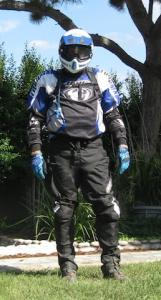
Agree with all above.... When going over 30 mph, or in dusty conditions, or when front tire is kicking up debris, and not in the lead, goggles are definitely on. If solo on cleanish road, especially on steep slow climbs, no goggles needed, and much much cooler, only glasses are fine. When Goggles are on, I use SCOTT OTG (Over the glasses) which are similar to oakley, but maybe not as fancy, but not as expensive. They have a nice slot for the frame to slide by without putting any pressure on your temples, nor allowing a gap for dust to find its way under the goggle. I ride with Goggles 90 % of the time. However, once it gets gnarly, or when behind a group spraying dust everywhere, or for long fast paved rides back to the truck at night, or in mega powder dust, rocks tossed back from other riders, rain, snow, cold, bees, gnat swarms, etc... I drop the Adventure Helmet clear screen on helmet right over the goggles and smile from the significantly increased additional protection. Not often, but seems heaven sent when I need to. I have tried the helmet shield only, with Goggles in the back pouch, but almost always, it gets too hot real quick and I have to pull over and get goggles on. Maybe a fancy helmet that breaths super good doesn't heat up as much. I wear a lower cost helmet (G-Max), but it has done well, especially because it is one of the only adventure helmets that allow the helmet shield to be pulled up so far that when wearing goggles only, the helmet screen is entirely out of view. -
Happy Birthday to you both! Dirt Dame, you sure rode great the other day to Julian and back on the SDAR ride - Yahoo, well done.
