


Crash_Man
-
Content Count
75 -
Joined
-
Last visited
Everything posted by Crash_Man
-
New Tusk Highland rackless vs Moskomoto reckless 80 v2
Crash_Man replied to ADV Bum's topic in Luggage and racks
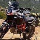
I have the Mosko Moto Backcountry 35L Pannier Kit and the Backcountry Duffle/Pack I have used many times on my KTM 1190 R. They are great quality but very expensive. I was wondering when a company would come out with a less expensive version. My Mosko duffle is pretty big, too big really, on the back and I went to a smaller waterproof bag. The 35L Pannier side bags are great. I can't tell in the pictures if the Mosko Quality is $300.00 better though? -
Who wants to do the Nevada Backcountry Discovery Route (NVBDR)
Crash_Man replied to Crash_Man's topic in Informal Local Rides & Who's Going Riding!
I will be riding my KTM 1190 Adventure R. What I can tell from the map the only semi long road section is at the beginning of section 6. The only real sand will be in the first section we do which will be section 2. When you are 100% in go to this website and sign up for the ride. It's all free just easier for me to track who is going. Thanks. -
Who wants to do the Nevada Backcountry Discovery Route (NVBDR)
Crash_Man posted a topic in Informal Local Rides & Who's Going Riding!
The NVBDR is a scenic ride across Nevada, beginning in Oatman, AZ, and finishing in Jarbidge, NV. I plan to start this ride in Pahrump NV. Created for dual-sport and adventure motorcyclists, this 900-mile south-to-north route primarily uses dirt roads to lead riders through Nevada’s expansive deserts, open sagebrush valleys, and seemingly endless mountain ranges. Ride dates September 23rd to September 30th 2017. The Plan is to leave from Temecula on Saturday morning September 23rd and hightail it to Pahrump, Nevada which is about a 4.5 hour ride. This will put us at the beginning of section 2. Section 1 is allot of sand and will be to hot in Sept. Decision point: Do we jump on section 2 or what till next day? Once we hit section 3 the elevation will make it nice and cool. I am also open to doing this ride North to South. It is a 10 hour ride to Jarbidge NV from Temecula if we start at the north end of the route. Once we start we should be able to do one section a day except day two which we will do a little more than one section. This will depend on Hotel and Camping locations. I want this to be a fun and stress free ride. If we see something cool We can stop and check it out. I do not want to camp every night but Hotel it at least two nights. We should arrive in Jarbidge, NV, the end of the trip, by Friday. That gives us two days to get home via the hard ball road. It is 10 hours from Jarbidge to Temecula for reference. We would leave Saturday morning to head home. I plan to be home Saturday sometime to rest Sunday. If we do this ride backwards starting in Jarbidge NV and riding South than we would still end in Pahrump NV or you could ball out whenever you wanted to. I am flexible. This is not a real hard ride even for big bikes. Here is a link to the Website for more info. NVBDR Webpage To download the GPS tracks look on the right side of the NVBDR webpage under NVBDR Information. Second link down. If you plan to go you should probe buy a hard Map for $14.00. Purchase Map or CD Here. Let's do this! This will be a GREAT ride. Cost for the ride will be be food, Fuel and when we stay at a Hotel. Tracks are free. I am in no way affiliated with the NVBDR web-page and I am not making any money on this ride. Contact me at 760-419-1847. -
How do I make the subject line of my post bold? I tried using the "B" bold tab but no go?
-
Fun little ride on my KTM 1190 Adventure R.
Crash_Man posted a topic in 1 to 3 Day Ride Write-Ups, Stories and Photos
-
Fun little ride on my KTM 1190 Adventure R.
Crash_Man replied to Crash_Man's topic in 1 to 3 Day Ride Write-Ups, Stories and Photos
YA Both times. The hardest part was getting my bike up after I dropped it. Took me about an hour. I had to rap my tow strap around the hand grip and pull with my body so the wheels would drop down into the rut. That was the only way I could move the beast. Had to do it for the front and back. -
Fun little ride on my KTM 1190 Adventure R.
Crash_Man replied to Crash_Man's topic in 1 to 3 Day Ride Write-Ups, Stories and Photos
Not really bad. I did break my mirror and scratched the hell out of my cash bars! That's what they are for anyway and I have KTM orange paint. No problem. -
14th Annual Anza Borrego Desert Dash
Crash_Man replied to KTMrad's topic in Upcoming Organized or Promoted Rides and Events
Great thanks. California Dual Sport Riders meetup has 14 people that signed on to ride. Most should have submitted forms already. -
14th Annual Anza Borrego Desert Dash
Crash_Man replied to KTMrad's topic in Upcoming Organized or Promoted Rides and Events
Is it possible to register and pay the day of the event? -
14th Annual Anza Borrego Desert Dash
Crash_Man replied to KTMrad's topic in Upcoming Organized or Promoted Rides and Events
I added this event to the So Cal Dirt Bike meetup group and the California Dual Sport Meetup group website. We will see how many people we can get to come and support. -
TEST Ride The California Adventure Trail (CAT)
Crash_Man posted a topic in Informal Local Rides & Who's Going Riding!
My plan is to leave Saturday morning 5th of November and jump on GPS Kevin's CAT trail were it crosses the 371. I want to ride the route as far as we can till Saturday morning the 12th. On Saturday morning I plan to jump on pavement and hi-diddle it back home. Hopefully being able to rest on Sunday. I will bring camping gear and camp some nights and hotel it others. I do not plan on killing myself to make a certain mileage for the day. What ever we make we make. This is a TEST ride to validate GPS Kevin's tracks so we might do some exploring also? Test riders will need to record gps tracklog information as they ride each section, take key pictures along the way and write a short description for each ride section. I will be riding my KTM 1190 Adventure R. If you are planning on going contact me and I will get you the tracks or contact GPS Kevin for them. You will be one of the first people to ride this new route! Any questions give me a call. 760-419-1847 More Info can be found here on this ride. SO What is the CAT? The CAT is just like AZBDR or other Back Country Discovery Routes except you cannot buy a fancy map at this time. The California Adventure Trail (CAT) is a remote motorcycle route consisting of a mix of dirt roads and back paved roads. The route was designed for adventure motorcycles and dual sport motorcycles but it is also well suited for Jeeps and 4x4s. There are Red, Green and Blue options. The CAT starts at the Mexico border and travels to the Oregon border. In the south, the route follows through the Mountains of Cuyamaca, San Jacinto and Big Bear. In the middle part of the state the route follows the famous Sierra Nevada mountain range and in the north, the route follows the Cascade Range. These are some of the best and most remote routes in the west. The route is best traveled in the summer and fall; late spring can also be good in light snow years. ( We will not be doing the whole route) The CAT route has been designed with options for difficulty levels depending on your skill level and desires. The main CAT trail is shown on maps in blue. Some sections can be tough and during those sections riders have an option to take green or easier paved routes. For advanced riders on smaller dual sport bikes I have added some tough options, even singletrack in places. These red options are not recommended for larger bikes or Jeeps. -
TEST Ride The California Adventure Trail (CAT)
Crash_Man replied to Crash_Man's topic in Informal Local Rides & Who's Going Riding!
This ride is only two weeks away if anyone want to join me. -
Crawdaddy's "Clubs invitational" Bullhead City - 11/3-6
Crash_Man replied to Crawdaddy's topic in Informal Local Rides & Who's Going Riding!
I would love to do this ride with you. Unfortunately I am doing the CAT starting that same weekend on my 1190. That is a great area to ride and I don't get out there often enough. -
TEST Ride The California Adventure Trail (CAT)
Crash_Man replied to Crash_Man's topic in Informal Local Rides & Who's Going Riding!
Sounds good let me know and when I get the tracks I will send them over to you. -
Team 5150 does AZBDR in 3 1/2 days...
Crash_Man replied to Oracle's topic in 4 Days & Longer Trip Write-Ups and Photos
Just read your ride report and it was outstanding. I did this same route the month before except we jumped on the TAT at the end of the AZBDR and took that into Vegas. I also would love to do this ride again taking a little more time. We did the AZBDR and the TAT into Vegas in seven days. I did not see it mentioned but how did you guys like that first sand section or did you take the bypass? Great write up we have many of the same pictures! -
Gnarly, Nasty, Difficult Trails - PHOTOS !
Crash_Man replied to KTMrad's topic in A Forum for GENERAL PHOTOS & Videos
Here are two pictures from our 325 mile two day ride around the Lake Topaz area. The sunset is just a really nice picture. -
2015 Arizona Trail Riders Howling at the Moon Dual Sport Ride
Crash_Man posted a topic in 1 to 3 Day Ride Write-Ups, Stories and Photos
This past weekend we did the 2015 Arizona Trail Riders Howling at the Moon Dual Sport ride. It was a great group with me, Tim Funk, Vaudois Handley, Brandt Lundahl and Matt. This was most of the group’s first time riding in the Payson Arizona area and it was spectacular. The Arizona Trail Riders did an outstanding job organizing this ride and I don’t think I have eaten so well since riding to the Bar 10 with Crawdaddy. Breakfast at the Elks club both days and Saturday nights Prime rib was good to go. We met V-Dog at the Housten Mesa camp ground on Friday and setup camp for the weekend. I knew it was going to be a great weekend when a hurd of Elk bounded across the road just in front of us on the way back from checking in. Tim Funk and I on the road to Payson Az. Long drive pulling my Toy Hauler from Temecula. Camp almost setup. Looking forward to a fire and getting my beer on! Day one of the ride was 165 miles of mixed trails of highway, dirt roads and some two track with a little single track thrown in. The “A” loop was not all that difficult but had some really stunning scenery. Some pretty easy trails. Day two started out with a little pavement and than turned into an 85 mile epic day of riding. The only down side was Tim getting two flats on his back tire. The first one took three plugs to fix ( we run Tubliss ) and the second was a nail that went all the way through even the Tubliss system. Another problem we had was that some how Tim, Brandt and Matt took a wrong turn and wound up behind V-Dog and myself. Not riding with radios, this is being fixed, V-dog and I thought they were in front of us and as hard as we rode we could not catch them! At each gate we were like " Man how come they are not stopping!" After a while we stopped, V-Dog was not feeling good, he told me to go and he would catch up. He decided to head back at the next main dirt road and I recieved a texted letting me know he was at the camp. A little pavement to start. Than into some nice dirt. It was pretty wet so great traction and no dust. After a while it started getting a little rocky. Than got really rocky. Image does not due justice to how steep it was. Little flashback of Big Bear. About half way up. Than... V-Dog and myself at one of the cattle gates wondering why nobody waited for us! I hit a puddle and tried to gun it through. Did a 180 and dropped in the mud! Was pretty funny all in all. Looking back at the puddle. You can see mt tire tracks going to the left. After riding for awhile I stopped to wait for V-dog and eat. I had cell service and found out he had headed back. This was near the end about 20 miles from home. Great area and I look forward to going back. All in all a great weekend with a great group of riders. Next year the ride is in Prescott Az and should be once again off the charts! -
3.5 days with a BIG BIKE 2 BIG BEAR and more
Crash_Man replied to Mr.JAJA's topic in 1 to 3 Day Ride Write-Ups, Stories and Photos
This is what I need to do on my 1190 to get use to all my Camping gear. Well done. -
2015 Arizona Trail Riders Howling at the Moon Dual Sport Ride
Crash_Man replied to Crash_Man's topic in 1 to 3 Day Ride Write-Ups, Stories and Photos
I have the tracks. We camped at he Houston Mesa Campground which was really nice. No hookups for the RV but the tracks go past the camp ground. Pulling my 28 foot Toy Hauler it took us about 7.5 hours to get there. They are paving the 10 when you get close to Phoenix az so be ready. This was a great ride and I really look forward to next year. -
Arizona Backcountry Discovery Route (AZBDR)
Crash_Man replied to Crash_Man's topic in Informal Local Rides & Who's Going Riding!
Not sure if this ride is going to happen or not. I can't find anyone that can get the time off to do it. V-Dog will do part of it but I am hesitant to ride it alone on my 1190 R. On my 500EXC no problem but I am new to the Big 1190 and don't feel like riding it without any support until I have more exsperiance. -
Arizona Backcountry Discovery Route (AZBDR)
Crash_Man posted a topic in Informal Local Rides & Who's Going Riding!
I am planning on doing the AZBDR Nov 8th to NLT the 14th on my 1190 Adventure R. At this time I plan on leaving early Saturday morning so we can begin the route Sunday morning. I would leave Temecula early Saturday morning for Sierra Vista, AZ stopping there to spend the night. We would leave early the next morning to start the AZBDR. The start is only 30 min from Sierra Vista. It is 7 1/2 to 8 hours to Sierra Vista. If you want to go we can meet and work out times and go over the map. Below is brief description of the ride. I want to Camp when possible but getting a room a couple nights sounds good also. As it states below tracks are free to down load from the website and I recommend ordering a map. I can be reached at 760-419-1847 or email me. The official start to the AZBDR is a stones throw from the Mexico border in the Coronado National Monument. This is an interesting area both geographically and historically. It is the center of four major biogeographic provinces: Madrean, Sonoran, Chihuahuan, and Southern Rockies/Mogollon. It is also the site of Francisco Vasquez de Coronado Expedition of 1540-1542. Information about both can be found at the interpretive overlook a few miles from the park entrance. From there, it's a mellow ride along the border fence using wide graded dirt roads before heading north to the small town of Sonoita. Fuel up here for your journey through Empire Ranch - historic working cattle ranch from the 1870s. Highlights: Views to Mexico, Ride along the border fence, Visiting Tombstone & Bisbee. Exploring Empire Ranch Headquarters. Heads Up: Heavy Border Patrol activity, be careful in blind corners. DEEP SAND starting at mile 83 near Empire Ranch. Easier alternate is available. Fuel & food available in Sonoita. Camping available at Parker Canyon Lake & Empire Ranch. Many lodging options in Benson. The AZBDR is the fourth route developed by the Backcountry Discovery Routes organization for dual-sport and adventure motorcycle travel. This scenic 750-mile south-to-north route crosses the state of Arizona beginning at the Mexico border and finishing at the Utah border. The route has been created specifically for dual-sport and adventure motorcyclists who are interested in exploring Arizona’s remote backcountry. It utilizes many remote dirt roads and leads riders through iconic locations including the Mogollon Rim, Sunset Crater National Monument, Grand Canyon and the Navajo Nation, as well as the historic mining towns of Tombstone and Globe, AZ. The AZBDR documentary DVD and the water-and tear-resistant Butler Motorcycle Map are available for sale at the BDR store. The free GPS tracks, digital map and the route's FAQ and photo gallery are located on the website. http://www.backcountrydiscoveryroutes.com/AZBDR -
2016 SDAR Desert Dash suggestions
Crash_Man replied to ADV Bum's topic in Upcoming Organized or Promoted Rides and Events
If there is a vote I vote for "making the usual day 2 track (Squeeze/Ledges/Dropoff/Slot Canyon/Fonts/Borrego Springs (lunch/gas)/Culp/jasper/Grapevine/Rodriguez/Oriflamme/Mason - back to Butterfield) the day 1 track and shortening the day in the desert on day 2.." as Crawdaddy suggests. I have done this ride three or four times and personally this my be a good thing becouse it needed something differant. I am not for day two having 20+ pavement miles for the small bikes though. I might be up for thrashing my 1190 on day 2 as a good change but don't think it should be big bike only becouse it might limit your turnout. Just my 2 cents this has always been a great event in a really nice location. -
Arizona Backcountry Discovery Route (AZBDR)
Crash_Man replied to Crash_Man's topic in Informal Local Rides & Who's Going Riding!
Thanks! -
Arizona Backcountry Discovery Route (AZBDR)
Crash_Man replied to Crash_Man's topic in Informal Local Rides & Who's Going Riding!
Afry, I checked out your report and you mantioned having tracks to go around the bad rock section. Can you send me those tracks? Buckleycw@gmail.com Thanks, Semper Fi. -
Arizona Backcountry Discovery Route (AZBDR)
Crash_Man replied to Crash_Man's topic in Informal Local Rides & Who's Going Riding!
What logistics? I know about getting permits for the first part and the indian reservation permit, anyting else besides normal ride planning?