


Brian Masters
-
Content Count
100 -
Joined
-
Last visited
Posts posted by Brian Masters
-
-
It was a good ride. I did learn unless you are a moto god don't do the trail to wright mine. The "road" is all mine tailings way to lose to get any traction on to come back out. All the other areas I hit up were good fun. Experienced big bike riders I think could enjoy it all, new big bikes riders might find parts a little tough/intimidating.
-
I'm not plannig to go into gnarly area this time. My plan is
2N54, 2N13, 2N80?, 3N14, 3N12, 3N16
Possibly 3N11 to Wright mine
Mostly fire roads, The wright mine portion is the hardest part planned. It's not real rough or loose, but is a long hill with a steep drop off.
It's video is from the mine out. Start to 2:11 is the mine trail, the second part of the video is 3N17 heading East
-
Husky TE 511. My trailer is tiny only room for one bike.
-
Yep just day tripping
-
I'm planning to trailer up and park at the crab flats trail head. Easy fire roads newbie and big bike welcome. Kickstand up at 9:00. 40 Mike loop plus some side trails depending on the group.
Trail head
Dropped Pin
near Crab Flats Rd, Green Valley Lake, CA 92341
https://goo.gl/maps/KeUy9sZYjyB26195079862
-
Exit pine valley, head south park before it turns to dirt.
About a 50 mile loop
-
Kickstand up at 8:00am. Mix of dirt and street. Meet at cul de sac
6195079862
-
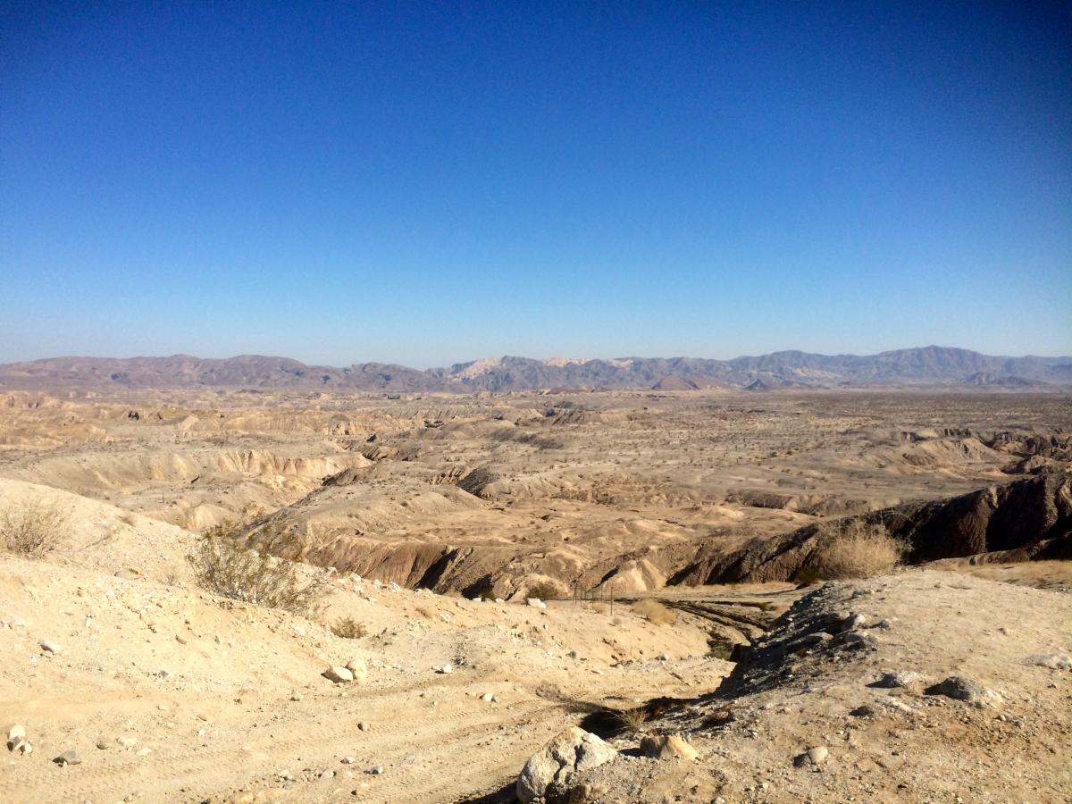
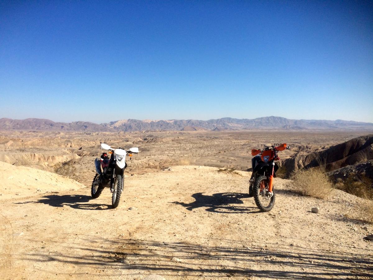
Thanks to WCGIV for posting this up. We had a great day. 2 Husky's exploring Ocotillo wells.
Tracklog, and videos.
http://adventures.garmin.com/en-US/by/johndoegeneric/sdar-2-11-17/#.WKCpxxIrJE4
-
I'm in, post up where you camp. I'll come out in the morning. I'm on a TE511.
-
1 minute ago, KTMrad said:That is strange....nobody else has ever reported that problem.
Also, why do u keep signing in and out...once you're logged on, u shouldn't have to login again unless u log out.
This seems like a unique issue to your computer and/or phone.
every time I open web page i'm logged out again, doesn't matter which device, or browser. I'll poke around more see if it's something strange in my settings. <shrug>
-
Password failure. Every time I visit the site my password is not valid again... even if it's the same one I used 20 minutes ago.
-
I've not been up in that area for a while and was surprised at how rough the main road from Pine Vally was. How does Kernan compare in difficulty? Thinking about heading that way next weekend or possibly do the Loop up through Laguna.
On another Note planning on getting busy with the club again. Got busy with other stuff, and now want to focus on more day trip rides.
-
The radio is the Baofeng UV5r. Baofeng has put out a few similar models now each with slightly different frequency ranges or antenna the widest range and longest antenna can be picked up from amazon for 35 bucks.
Not a bad package deal. I did have an issue with the helmet set having a bad solder joint, and bad insulation in the knuckle where everything splices.
-
those both look pretty nice, I use the Ion air pro2 so far happy with it.
-
Very cool, Brian. Very cool.
Brings a few questions to mind:
1. I assume the vid & pics are from a GoPro, but did you somehow sync it together with your Garmin, or did you just pick where to insert the pics/vids from the GoPro into the GPS track?
2. Is there a way to get the GPS data from this so I could upload to another GPS device like an InReach?
3. I'm just using my phone for GPS right now but it drains battery fast, so I'm in the process of choosing a GPS unit to use. I'm hoping to get one with EMS/SOS capabilities as well. Does your Garmin work this way?
1. Drag and drop operation... if your video is Geotagged it will be placed in the map automatically.
2. I don't know if you can DL it directly from the website, but you can get it here... https://drive.google.com/file/d/0B6JX-m5eUMmzZWx5OWFxR1Zibm8/view?usp=sharing
3. I have an On spot attached to the shoulder strap of my backpack for SOS, and use a Garmin Zumo 350 for nav and route tracking. There have been notable issues with an SOS device attached to the bike rather than the rider. Make sure you can get to it if separated from the machine, or injured with it in my backpack I wasn't sure I could get to it to push the buttons if I was actually hurt. Now it sits in easy reach on the left strap of my pack.
-
Garmin Adventure, Videos, and GPS info
http://adventures.garmin.com/by/johndoegeneric/1-3-15-ocotillo-to-diablo-drop-off/
-
I've been hearing quite a bit about Fish Creek and Sandstone Canyon. Looking forward to the GPS track. Killer pics. Thanks for the RR.
Do you guys trailer out there? If so, where's the trailhead you take off from?
We trailered out, parked in the dirt lot by the Cheveron in Ocotillo. Made for a 78 mile loop.
-
EastcountyKTM and I did a 78 mile loop around South Anza-Borrego. I learned that I can go about 70 miles before the low fuel light comes on, about 75 and it starts missing. I did plan ahead and had an MSR bottle with me.
I went down pretty good in a silt pocket, a little sore and bruised up this morning, but nothing major. Bike looks fine and started right up after. It'll get a good inspection this after noon.
2 pics to tease with, GPS track and video later.


-
I'd like to do the 75 mile loop if you're still going
The long ride it is then, see you in the AM
-
I'm on 4 wheels tomorrow - Grey Tundra 4D and new black Rubicon 4D so say hi if you see us. I'll have tools, gas, etc on board. Mostly headed to the Split Mtn/Fish Creek area but driving thru Ocotillo.
Almost tempting to leave the bike home and just take the Wrangler out.
-
Just finished route checking, depending on who's there and what they're up for either...
down diablo, out fish creek and around approximately 75 miles or
across Stagecoach overland route, and back around approximately 45 miles.
-
Basically depending on fuel levels and riders
-
Meet at the gas station in Ocotillo CA 9:00. Run down the concrete highway, swing by Dos Cabesas, head out Pepcorn slot, over to Csnyon Sin Nombre, and points beyond...
Lots of sand, moderate pace, all skill levels welcome
-
One of my favorite rides...rumor has it that the area is now a "plated area" onlyWant to ride it?? :torch:/>
If we go stealth there is a chance sneaking up on some big horn sheep
I can verify there is a Sign with the Though Shall have Plates commandment
Big Bear 5-11-2019. Nope
in Informal Local Rides & Who's Going Riding!
Posted · Edited by Brian Masters
failed to check weather reports
Nope, change of plans made reservations a month ago... high of 50 and 90% chance of rain... I’ll try this again for July
I'm not camping at Crab Flats this weekend. The plan was to explore fire roads south of Big Bear before looping through town and back to the campground. All skill levels and bike types welcome, mostly dirt. Lunch on the trail, will adapt route and ride to skill level/bikes involved. Flexible kickstands up and meeting points.