

Travis Gill
-
Content Count
113 -
Joined
-
Last visited
Everything posted by Travis Gill
-
Thinking of scoping out the "Border Run" Trail from Campo to J
Travis Gill posted a topic in Informal Local Rides & Who's Going Riding!
I was looking at this exceptional map created by gpsKevin: http://tinyurl.com/z7pl7cr ...and noticed a trail from Campo to Jacumba labeled "Border Run". Does anyone have any first-hand experience on this trail? Is it open all the way through? I was thinking of running it this weekend sometime. -
Best San Diego Adventure Ride Maps Ever: In both GPS Maps and Prints
Travis Gill replied to gpskevin's topic in Informal Local Rides & Who's Going Riding!
My WHOLEHEARTED THANKS! As a new adventure rider to the San Diego area this map has been a TREMENDOUS WEALTH of information. My goal is to have ridden most, if not all, of the colored roads before I have to move next summer. A HUGE thanks to gpsKeven! -
Team 5150 does AZBDR in 3 1/2 days...
Travis Gill replied to Oracle's topic in 4 Days & Longer Trip Write-Ups and Photos
Great stuff. Thanks for sharing the adventure. ? -
Team 5150 does AZBDR in 3 1/2 days...
Travis Gill replied to Oracle's topic in 4 Days & Longer Trip Write-Ups and Photos
All good. It's interesting how the same mileage and trails can be so different. Definitely worth experiencing for yourself! -
Very nice. Enjoy the new ride.
-
Baja ride
Travis Gill replied to rojodogg's topic in Baja Info, Upcoming Rides, Ride Reports, Photos, etc.
High five! ? Good stuff. -
Baja 500 riders down :(
Travis Gill replied to Afry's topic in Baja Info, Upcoming Rides, Ride Reports, Photos, etc.
-
Team 5150 does AZBDR in 3 1/2 days...
Travis Gill replied to Oracle's topic in 4 Days & Longer Trip Write-Ups and Photos
It's crazy how doing this trip a month later makes for such a different adventure. I almost decided to do under-armor and a jersey like you guys did... However, that would have been a mistake since we dealt with 75 and below temps for all but three days of the 10. You covered A LOT of ground in short order. I'm trying to determine why we were so much slower... It could be that we are fairly new riders so the confidence of riding fast isn't there. I also think we spent more time documenting the trip which is something I enjoy almost as much as the riding. It sounds like you have a great group of riders who made great company. Well done! Looking forward to the Navajo Nation... -
AZBDR - Two Noobs, Two Mules, Two Weeks Off...
Travis Gill replied to Travis Gill's topic in 4 Days & Longer Trip Write-Ups and Photos
Muy Bien! Thanks for the positive comments. -
AZBDR - Two Noobs, Two Mules, Two Weeks Off...
Travis Gill posted a topic in 4 Days & Longer Trip Write-Ups and Photos
The Arizona Backcountry Discovery Route. Feeling excited but also a bit nervous. I feel we've put the due diligence in getting prepared to include mapping and documenting the adventure. It's only been a year of riding for us, but we've trained and practiced to ensure we both have the skills needed to complete the trail. It's the largest off-road motorcycle trip we've planned. Our 'rough' plan is to cover the route in 9 days: Sat, Apr 23: Leave Casa Grande, ride to start the trail to Sonora. Sun, Apr 24: Senora to Benson Mon, Apr 25: Benson to Mammoth Tue, Apr 26: Mammoth to Globe Wed, Apr 27: Globe to Young Thu, Apr 28: Young to Flagstaff Fri, Apr 29: Flagstaff to Cameron Sat, Apr 30: Cameron to Marble Canyon Sun, May 1: Marble Canyon to Utah Side-trips to Tombstone, Sedona, and the Wave. Any others worth seeing? I just made room on the iPhone and GoPro for lots of pictures and videos. Stay tuned... Cheers, Travis and Chantil -
AZBDR - Two Noobs, Two Mules, Two Weeks Off...
Travis Gill replied to Travis Gill's topic in 4 Days & Longer Trip Write-Ups and Photos
Thanks for the encouraging comments! An epic adventure like the AZBDR seemed to deserve a great ride report. We are glad we could share it via words, photos, and videos. -
AZBDR - Two Noobs, Two Mules, Two Weeks Off...
Travis Gill replied to Travis Gill's topic in 4 Days & Longer Trip Write-Ups and Photos
Thank you. Great news on subscribing. My lifetime goal is 10 subscribers. -
AZBDR - Two Noobs, Two Mules, Two Weeks Off...
Travis Gill replied to Travis Gill's topic in 4 Days & Longer Trip Write-Ups and Photos
As a GRAND FINALE I've put together a short video from all the GoPro and iPhone footage that we shot on the trip. Enjoy!: AZBDR - Husband & Wife Motorcycle Adventure -
Beautiful pictures - especially the cowpoke. Moab is one of my favorite destinations. Gotta go back now that I've discovered motorcycles.
-
AZBDR - Two Noobs, Two Mules, Two Weeks Off...
Travis Gill replied to Travis Gill's topic in 4 Days & Longer Trip Write-Ups and Photos
AZBDR Day 11, Thursday, May 5th: 317 miles paved + 2 miles dirt = 319 total miles Map of Day 11 Normally I hate mornings and, if given the chance, I’ll sleep until 8 or 9 AM. However, all during this trip I was the first to wake up each day. I guess I was just really excited about getting on the trail and experiencing new adventure. Even today, on our last day of the trip, I was ready to get going. Packing up went well enough. I felt like we had a pretty good system that allowed us to pack the tent, sleeping bags, and camping gear onto the mules in about 30 minutes. Our last camping location yards from where we experienced all the mud, just less than a week before. We decided to forgo breakfast in camp in order to make good time to Sedona. Besides a nice, hot, and hearty breakfast sounded like a great way to start our return home. We rode the two short miles of dirt (our only dirt of the day) before hitting pavement at AZ SR-89. Before to long we were passing though Flagstaff and on our way to Sedona via the AZ SR-89 alternate. Pure motorcycle bliss! Just look at all those curves. The road down into Sedona was beautiful. Amazingly paved roads led us into Sedona with incredible views around every curve. Beautiful Sedona! I wish we really could have had just a day to explore it. The surrounding mesas are incredibly beautiful and there is a lot to do there. We enjoyed riding around Sedona through the late morning traffic towards our destination of The Coffee Pot Restaurant. Breakfast was recommended by a friend who has been living and working in Sedona. Unfortunately we couldn’t meet up during the very short time we were passing through. After an enjoyable breakfast, we continued southwest via AZ SR-89A to AZ SR-260. Much of the riding was on excellent, two-lane roads, surrounded by green forests. We could have taken the freeway and rode through Phoenix to our destination but what fun would that have been? Besides, the single-cylinder 650s really don’t enjoy freeway cruising at 75MPH; they are much more content in the 50-60 MPH range. Before long we were riding along the AZ SR-188 and into the Tonto National Forest. For lunch we stopped at the well-maintained Vineyard Canyon Picnic Site. The Theodore Roosevelt Lake looked like a great place to take reprieve from the hot Arizona temperature. Beautiful! The Roosevelt Lake Bridge is an incredible looking landmark painted a striking light blue. A view of the Roosevelt Lake Bridge from the Roosevelt Dam overlook. After leaving AZ SR-188 we turned onto the “Apache Trail”, also know as AZ SR-88. My bike, Apache, seemed to enjoy this section of road. We made good time with the acceptation of some road construction. This was one of the hottest days of our trip. As we continue south, the temperature continued to climb reaching over 100°F. The 650’s persisted along belching hot air from engine through vents that blew onto my right knee. We pressed onward in our goal to reach Coolidge before dark. A short tunnel section on Apache Trail – AZ SR 88. The final press, into Coolidge was uneventful. We rolled into the driveway without any fanfare, turned off the ignition, and gently rolled the mules onto their kickstands. We were done. Mission complete! A clean GS is a dirty shame. Later that evening, I returned to look the bikes over and unload the gear such that they could be returned to the trailer for heading back to San Diego. There is something hard to describe about the sense of fondness that you have about a motorcycle. In their simplest form they are just a bunch of mechanical, rubber, electrical, and plastic parts. Each part really isn’t spectacular on it’s own. Yet together, they create something quite magical. In the right hands they are downright enchanting. I have a lot of respect for how well engineered motorcycles are, especially these adventure bikes. I can’t even remember how many times I had a “tip-over” on Apache. If I had to guess, it was probably 20 times. None of it was at speed and most of it was during the sand and muddy sections of the trail. Apache went through snow, rain, sleet, sand, mud, and 100 degree heat and didn’t even give any sign of quitting… … except for his rear sprocket! Dang, now that is getting your money’s worth. Time for a new chain and sprockets so that we can share more adventures together! Until next time, Travis & Chantil -
AZBDR - Two Noobs, Two Mules, Two Weeks Off...
Travis Gill replied to Travis Gill's topic in 4 Days & Longer Trip Write-Ups and Photos
Welcome. Thanks for the comment. The RR is almost done. Like the actual ride, I bummed that it's coming to and end but glad that I can relax from this last adventure and focus on the next one? Perhaps Baja? I've got one more pavement day to post. At the end I'll post the culmination of all the footage we took in a short music video. More to come... -
AZBDR - Two Noobs, Two Mules, Two Weeks Off...
Travis Gill replied to Travis Gill's topic in 4 Days & Longer Trip Write-Ups and Photos
AZBDR Day 10, Wednesday, May 4th: 128 miles paved + 69 miles dirt = 197 total miles Map of Day 10 We woke up in Arizona, packed up the bikes, which were parked in Utah, and rode north along the dirt road of House Rock Valley. Once we reached the pavement of Hwy-89 we headed east where we passed Lake Powell and into the town of Page, AZ. Breakfast, gas, and water (in that order) were our purpose for stopping. We found breakfast at the Canyon Crepes Café. It was a bit difficult to find because it’s tucked away in a back of a shopping area but its well worth it. (http://www.canyoncrepescafe.com) An excellent breakfast of crepes ensured our morning was off to a great start! A beautiful mural of Japanese style Koi Fish was painted just outside the restaurant. After topping off our gas tanks and water bladders. We continued south along the Hwy-89 to Cameron, AZ where we topped off the fuel tanks once again. VIDEO: The newly built roundabout in Cameron. Roundabouts are fun to go-round-about! The center looked like it might have a Native American symbol or something painted on it but Google Earth doesn’t have the areal view yet. Once we reached Grey Mountain, we left the highway to reclaim the section of road we bypassed a few days back. Beautiful mesas populated the high desert scenery. Indian Route 6150 required a fairly long and rocky climb up to the top of the ridgeline. We were grateful to be climbing this steep section of trail instead of descending it. Once you reach the top of the ridge the road opens up and the trees, short of some small bushes, disappear from the landscape. On the horizon we saw the only tree for miles. We parked the bikes in the shade and took a little break from the heat. A single tree contrasts the miles of open prairie. Chantil relaxes in the cooler temperature of the only shade for miles. Indian Route 6150 continued west returning to the Kaibab National Forest. This portion of the road was a little muddy from the rains over the past weekend. There were sections that would have been near impossible to pass through just three days prior. We saw many rutted out section that looked like a 4WD vehicle struggled to get free from the thick, clay-like, mud. We understood that feeling all too well. Fortunately, the sun had dried out most of the muddy section. We just had to pick good lines to ensure we didn’t fall into the deep ruts. VIDEO: This section of the forest looked like it had been marked for thinning. The trees with the painted orange stripe were the fortunate ones; they were chosen to remain standing. The miles continued to pass under our K-60 Scout tires as we descended south from the wooded forest area to the flat plains. Chocolate, enjoying another short break under the shade of a lone juniper tree. VIDEO: This video took close to 10 minutes to get right. That poor beetle was flipped and tossed back and forth into the dirt while we attempted to capture the perfect moment. The final stretch of road before we reach the point we had to abandon the AZBDR due to heavy mud 5 day ago. VIDEO: We did it! We officially completed all of the AZBDR with the exception of the two sections that were marked “Expert Only”. I definitely felt like we earned this sticker! AZBDR complete! The sun was setting and it was time to find a place to camp for the night. We pulled off the road about 70 feet and set up camp for what was going to be our last camp of the trip. Tomorrow we leave the dirt to head back to Coolidge, AZ. But not before we stop and see beautiful Sedona, Tonto National Forest, and Theodore Roosevelt Lake along the way... -
AZBDR - Two Noobs, Two Mules, Two Weeks Off...
Travis Gill replied to Travis Gill's topic in 4 Days & Longer Trip Write-Ups and Photos
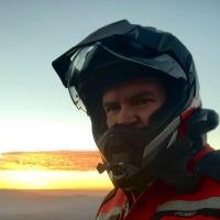
AZBDR Day 9, Tuesday, May 3nd: 45 miles paved + 62 miles dirt = 107 total miles Map of Day 9 I awoke early because I was excited to capture an iPhone time-lapse of the canyon during the sunrise. The iPhone was fully charged, I found the perfect ledge for the tripod, composed the canyon within the camera frame, and then started the process just before the light began to peer into the canyon. It was going to be epic!! NOT! I captured about an hour and a half of time-lapse, which made for a 30 second video. The problem was that the exposure was not preset so the iPhone auto exposed each image. The final product was terrible. I was a bit bummed because this was a one-time-only kinda thing. Oh well, I did get some good photos… Sunrise silhouetting our campsite. The campsite was so incredible and isolated. Right on the cliffside! And here is the tent rug we bought the day before. Also, this picture should be a cover photo for the Aplinestars Corozal Adventure Drystar Boots. Warming up some water for a hot breakfast to suppress the chilly morning of about 40º F. Apache and the Nexx XD-1 helmet (I should be getting paid for all this product placement) During our breakfast the canyon was splashed with rays of scenic sunlight. Chantil BMW G650GS named ‘Chocolate’. More product placement for BMW! The trail out of the campsite was a bit rutted with an 8-10 inch step made of sharp rocks. Last night we went down it; much easier with the help of gravity. This morning we would have to climb back up it. It was a bit technical but we both got up just fine. Had we tried to do an obstacle like that a week ago it would have been more of a challenge. Our off-road abilities were improving! On the 14-mile leg back to the main route we passed by some beautiful flowers growing in the middle of the two-track trail. The only shiny thing on my bike and I can’t even keep that clean. Oh well. A clean GS is a dirty shame. It wasn’t too long after hitting the trail that our low fuel lights came on. Once the light comes on I underestimate about 50 miles before we’re empty. This was the longest we had gone without fueling the entire trip and gas was less than 35 miles away. All good! Besides, we also had 1.75 gallons of extra gas in the RotoPax. We reached the pavement and continued north along the beautifully paved and isolated State Route 89A towards Marble Canyon. The beautiful views and wonderfully paved roads provide a break from the dirt. VIDEO: Magnificent two-lane State Route 89A. We stopped at Marble Canyon for some much needed gas, and water. I even chowed down on some convenience store nachos, which were surprisingly good. I think food taste better when you’re on the road. While leaving Marble Canyon I started to reflect on the entire trip and that it was coming to an end. Part of me really was bummed. I really didn’t want it to end. I wanted to continue through Utah, then Idaho, then through Canada all the way Alaska. I didn’t want to stop. We were about to turn north onto the very last section of dirt and I just wanted it to last forever. The last dirt section was marked by this sign for the Vermilion Cliffs. The Vermilion Cliffs were quite beautiful. VIDEO: Riding on the wide, grated, dirt road past the Vermilion Cliffs. Exploring an old, rustic cattle pen. As the road continued north the beautiful and diverse sandstone scenery became more plentiful. The GPS waypoint marks the Utah/Arizona border and the official end of the AZBDR. No there wasn't a huge field of green grass on the Utah side as indicated on the GPS map. We made it!! Utah or bust without any real busts (bikes or bodies). Celebratory jump for joy! We took a small break and then found the Stateline Campsite where we parked our mules in Utah and then set up camp 20 feet away in Arizona. This was our first, and only, developed campsite that we stayed at during the entire trip and the cost was FREE! Some may think that this is the end of the adventure… But fear not! Remember the mud from day 7? The near-zero progress forced us to forgo about 60 miles of the AZBDR. Tomorrow we plan on going back to complete that section from North to South. More to come… -
AZBDR - Two Noobs, Two Mules, Two Weeks Off...
Travis Gill replied to Travis Gill's topic in 4 Days & Longer Trip Write-Ups and Photos
We agree, especially after waiting in Flagstaff for too long. -
AZBDR - Two Noobs, Two Mules, Two Weeks Off...
Travis Gill replied to Travis Gill's topic in 4 Days & Longer Trip Write-Ups and Photos
AZBDR Day 8, Monday, May 2nd: 62 miles paved + 100 miles dirt = 162 total miles Map of Day 8 Monday morning brought a renewed energy! We were well rested, well supplied, and ready to make progress of our AZBDR adventure. I was also excited because this day was the one I had looked forward to since we learned of the AZBDR – Navajo Nation. The morning was cold and still quite wet. The snow had cleared from the roads but still remained on the shaded and shoulder areas. I was grateful that I didn’t convince myself to forgo bringing my heavy adventure jacket and cold weather riding gear for this trip. That would have been a mistake. We experienced climates that we never expected for Arizona in May. As we continued north along the pavement the conditions became better with each mile. The road shoulder went from snowy, to wet and muddy, and then to dry. We were relieved that today would end up being much more enjoyable than our mud slug-fest we faced a few days ago. Things were looking up. In Cameron, we stopped at the Navajo Visitors Center and purchased our Permits for $12.00 each. Believe me, this is WORTH EVERY PENNY, as you will discover from our pictures… Navajo Permit granting 24-hour passage to hundreds of miles of wild-west roads! This is much better than a ticket to Disney Land for sure. Look for the octagon shaped building. The gentleman who issued the permit gave us a warm greeting and was very helpful when we showed him the areas we wanted to explore from our Butler map. A few miles north we got sucked into the Cameron Trading Post. We were looking for a Native American style rug that we could put in front our tent but didn’t want to spend too much. There were magnets… … and minerals… … even coffee mugs… Finally we found the rug we were looking for! It ended up being a placemat for the dinner table but it was perfect. The intoxicating fever of consumption by the busloads of tourist got the best of me and I purchased a small dream catcher that I hoped would grant me some kind of favor as I traveled the Navajo Nation. Further research, after the trip, revealed that dreamcatchers originated from the Ojibwe people of Canada and Northeast United States. The Navajo probably find it to be an undesirable form of cultural appropriation. Anyhow, there it is hanging from my GPS mount hopefully catching my dreams of not getting broke, bloodied, and busted-up from getting thrown from my mule. Within a short while we were turning onto dirt. The roads were all wide and regularly leveled making for quick and effective travel. There was a really cool traditional home with stone walls and a wooden roof just off the main road that offered a short break. Our German made G650GSs fit into the Navajo landscape flawlessly. At least I think they do. Although the travel was quick, we seemed to take a lot of breaks because each corner revealed some really beautiful country. Small mesas pushed upwards from the earth by tectonic activity and then weathered by differential erosion made for some breathtaking scenery. For lunch we decided to drive the 5 miles to the overlook via Indian Route 6134. If you have the pleasure of traveling this area of the country then DO YOURSELF A HUGE FAVOR and ride out to this overlook. I find the Grand Canyon National Park to be an incredibly beautiful park but I also feel that it suffered from being way too commercialized. The Navajo Nation is one of the few areas you can still enjoy the majestic beauty of the Grand Canyon WITHOUT the tourism. Majestic cliff walls that give you a sense of vertigo as you approach their edges. It’s unconceivable to me that a river shaped such an incredible canyon. Two of the most beautiful things in my life; Chantil and Mother Earth. A red motorcycles might be the third most beautiful VIDEO: During our lunch we set up the iPhone on a tripod and took this incredible time-lapse movie. The mules graze patiently waiting for us to take in the amazing views around us. Desert flowers were in bloom and provided fresh life to contrast the harsh steepness of the cliffs on the horizon. The quietness and beauty was invigorating. A final picture of the two of us before we head south again to join the main route. On our way back to the main trail I noticed about 4 miles from the overlook that I didn’t have my CamelBak. I quick search revealed that I probably left it back at the overlook spot. Dang. I hurried back to the overlook to find my… … CamelBak right where it fell from my bike. It was just laying there… hoping that we would be magically reunited in a blissful hydrated embrace. I kid, but the CamelBak was really useful and I wouldn’t have done a trip like this without it. Once we were back on the main trail it was smooth rolling. Movie: Riding along the Indian Route 6134. Apparently the practice of shooting signs with a shotgun is alive and well in the Navajo Nation as well. More beautiful mesas. VIDEO: You think we would be smart enough to avoid mud after our experiences from three days ago. But this video was too beautiful to not capture. Apache, named after the red pony I rode as a little kid, in the Navajo Nation. ADV Rider stickers look much better dirty. More beauty as we continued north along the Indian Route 6133. We had heard about a great place to camp for the evening from another fellow ADVRider convict. I plotted the waypoint and I knew how to get to it via the 14 mile Indian Route 6110. However, we noticed on the Butler Map that there was a shorter route from the north. We searched and searched riding around on some pretty isolated single-tracks. We even had enough cell-phone signal to search for a route via Google Maps but came up empty. The route on the Butler map is a “unicorn road” because, like the unicorn, it DOESN’T EXIST! Although we were a bit frustrated with our search for the unicorn road it did offer us a chance to ride some less traveled trails. We came across the remains of a dead horse, which seemed to bring new life to the flowers that bloomed near the bleached skull. I tried to convince Chantil that she should figure a way to mount the skull to replace the fender on the G650GS. She wasn’t convinced. I still think it would have been a cool mod. We knew, from pictures, that the area we wanted to camp at was well worth heading the 25 miles back to the south. Gas was going to be an issue and we expected our low fuel lights to come on sometime tomorrow. Fortunately, we had about 50 miles each of spare fuel in the 1.75 gallon RotoPax. No problem. Chantil taking a little nap as she leaves the role of navigating to the campsite to me. We ended up getting to the overlook camp area (36º 24.244’ N 111º 50.055’ W) just after dark. That little blue dot is us on the majestic cliffs of the mighty Grand Canyon. Unfortunately, pictures of the campsite and the canyon will have to wait until Day 9… -
AZBDR - Two Noobs, Two Mules, Two Weeks Off...
Travis Gill replied to Travis Gill's topic in 4 Days & Longer Trip Write-Ups and Photos
Now that I've got you addicted... Send $50 via paypal to... Day 8 sneak peak: Good news... we are free from the bonds of Flagstaff as we continue north and into Navajo Nation. -
AZBDR - Two Noobs, Two Mules, Two Weeks Off...
Travis Gill replied to Travis Gill's topic in 4 Days & Longer Trip Write-Ups and Photos
Thank you! Three more days to follow... -
AZBDR - Two Noobs, Two Mules, Two Weeks Off...
Travis Gill replied to Travis Gill's topic in 4 Days & Longer Trip Write-Ups and Photos
AZBDR purgatory, Sunday, May 1st: 0 miles paved + 0 miles dirt = 0 total miles Snow! We woke up to snow this morning. Not a lot, but enough to make us feel bad for having to leave our mules outside in the uncovered parking lot. Poor babies. Two older gentlemen pulled in last night on their 1200GSs. Apparently they are from Canada and are on their way to Vegas. Despite the snow and cold, they suited up after breakfast and continued west. We decided to enjoy the cool morning and walk ourselves to church services. It was nice to recalibrate my thoughts on more spiritual matters since I was a bit down in the dumps about being “trapped” in Flagstaff. Guess where we are? It seemed to be nicer in every direction north, south, east, and west of Flagstaff! On our way from church services we stopped at Bushmaster Park. The playground was especially enticing since it looked really new and modern. We ended up playing for quite a while before returning to the hotel. Swings and zip-lines are fun at any age! That evening, part of our family arrived and we got to enjoy their company well into the night. We always have A LOT of fun when we reconnect with our family and it was great to see them once again. -
AZBDR - Two Noobs, Two Mules, Two Weeks Off...
Travis Gill replied to Travis Gill's topic in 4 Days & Longer Trip Write-Ups and Photos
AZBDR purgatory, Saturday, April 30th: 15 miles paved + 0 miles dirt = 15 total miles It has been raining off and on all day and it’s been pretty cold outside. The hotel room feels like it is closing in on me. I feel like a caged animal. We ran a few errands around town to include: • Power-washing both mules at the self-serve car wash. • Buying a new taillight bulb for Chantil’s mule. • Ordering a catered tray of Chick-fil-A nuggets. • Topping off our camp food at the grocery store. 120 Chick-fil-A nuggets. Ohhh sooooo yummy. We’ll eat these for the next three meals! They are expecting snow tomorrow in Flagstaff! Snow in May… -
AZBDR - Two Noobs, Two Mules, Two Weeks Off...
Travis Gill replied to Travis Gill's topic in 4 Days & Longer Trip Write-Ups and Photos
Amen to no injuries! I hope to write day 8 before tonight... BTW, I just finished doing a short music video of all the footage we shot. I'll hold off posting the video until after the ride report.